Showing posts with label railroad. Show all posts

Monday, May 24, 2021

Montbrook

 A small green sign directs the attentive motorist on US41 to an unimproved (read: dirt/sand) road that constitutes the community of Montbrook, Florida. Today, it is a collection of modest houses with rather large plots of land. At one time, in the early part of the twentieth century, the town of Montbrook was a stop on the rail line. It is difficult to say whether the town was prosperous. Today, all that remains are two structures from that era: a general store/post office and a former hotel. I have yet to find any information regarding the general store, which has set abandoned and uninhabited for many years. On the other hand. the hotel, built in 1904, is a private residence. It was moved to its current location in 1974, about 400 feet to the west from its former location. During the move, the former hotel acquired a brick façade. Now a residence, the building still retains its original flooring made from Dade County Florida pine.  Originally, the railroad tracks ran adjacent to the general store making it a short walk from the train stop to the hotel. At some point, however, the railroad tracks have been moved about a quarter of a mile east where it is still an active freight line.

The former hotel 

General Store / Post Office

Pine Floor 


Sunday, June 28, 2020

June on the C&O Canal Towpath

The return to the towpath, after three months of staying close to home because of the pandemic, was a difficult decision. But because I was in the most remote area of the C&O Canal, and I would minimize the interaction with other people, I decided to have some exploration during this COVID summer. What I did not realize was that the trail was so remote that it proved difficult to access. 

Exiting I-68, I had difficulty believing my GPS, which said that Bonds Landing was twelve miles away, but it would take 42 minutes to arrive. I was sure it could not be that long, and that it would correct itself as I got closer. If anything, the GPS was optimistic. What I did not realize was traveling though Green Ridge State Forest would be on narrow gravel roads, fording three steams on Carroll and Kasecamp roads, and dodging potholes that were capable of swallowing small cars. As nerve wracking as it was to drive, it was a fascinating journey with an old cemetery, stunning vistas, deer, and mosquitoes. 

The towpath was lush, and the undergrowth full. Within five minutes of beginning my walk I nearly stepped on an eastern ratsnake sunning itself. It is a reminder, early on, that I have not been on the trail in three months. This is not the same as walking in the neighborhood. Whenever I see a ratsnake, at first glance, I think it is a tree branch that has fallen across the path. But the curvature is a giveaway. It is the largest and most common snake in Maryland. Although it is nonpoisonous, its bite can be quite painful. 

I have been reading Peter Wohlleben’s seminal book, The Hidden Livers of Trees, in which he argues that our concept of life, communication, and cooperation is so deeply rooted in our own experience, it is difficult to conceive how other living things might experience the same things. We cannot adequately communicate with trees to determine if they contemplate experiences and relationships, thus we do not know if they have experiences like animals. But his description of how communities of trees share resources, help one another, and have knowledge to heal themselves certainly forces me consider trees differently. Walking along the edge of the canal, one becomes conscience of the number of trees that have succumbed. Often, you can find dead trees leaning against neighbors. It is almost as if the neighbors are cradling their dead neighbors in their comrade's repose. Looking at the remains of one tree resting against two neighbors, I was reminded of the Pennsylvania Railroad War Memorial at 30th Street Station in Philadelphia. The bronze statue, which honors those railroad workers who died during the Second World War, depicts the Archangel St. Michael supporting a lifeless body is a moving tribute. Perhaps trees do not grieve, but a long examination of nature can remind us of how we are part of something larger than ourselves. 

As I finished the month, there is a sense of excitement because I am less than twenty miles from the upstream terminus of the towpath at Cumberland, Maryland. Yet, it is sad that this portion of the journey is coming to an end. During the four trips to the towpath this month, I have encountered few other walkers, except for some near the aqueducts. It makes walking during the pandemic more socially responsible. But like many other things during a pandemic, it is an experience with minimal human interaction. This lack of interaction is not good for our mental health. It is tiring, but the regenerative powers of nature are still present. 


Cody meeting me as I neared the end of my 9.5 mile walk

Roby Cemetery 


Yellow-billed Cuckoo

Paw Paw Tunnel


Town Creek Aqueduct 

Orchard Oriole

Lock 68

Least Flycatcher


Oldtown Toll Bridge

Friday, July 5, 2019

Train Tunnels and Hemlocks


The mountainous roads of Central Pennsylvania can seem treacherous and can elicit white knuckles from passengers unaccustomed to traversing these rural highways. These essential roads that link opposite sides of the mountains are steep and curvy. Driving on PA234 in remote Perry County, trying to make our way to Fowlers Hollow State Park, we saw a brown wooden sign that pointed out directions to the “RR Tunnel,” without any further explanation. Of course, it was an invitation to investigation. We turned off onto an unpaved road named Hemlock Road, not knowing that we would later explore it more thoroughly.
The train tunnel in Big Spring State Park 
We parked the car in a small lot and braved the heat and an onslaught of insects traversing what promised to be a one-mile roundtrip to the location of an unfinished railroad tunnel. The proposed tunnel was meant to carry lumber to the other side of Conococheague Mountain. Started by the Newport and Shermans Valley Railroad, which operated in Perry County between 1890 and 1935, the uncompleted tunnel was abandoned presumably because of its unfeasibility. Later, the rail lines were used to ferry passengers to picnics in the early twentieth century. 

The former bed of the railroad tracks
The path and picnic areas, as well as some of the surrounding forest, constitutes the Big Spring State Forest Picnic Area today. With the work of the Civilian Conservation Corp, the state park was opened in 1936. We walked a human-built ridge that was once held a narrow-gauge railroad track to help remove timber to supply local industries, including a tannery and axe-handle maker. The humidity, along with temperatures in the mid-80s, make the walk less appealing than one would have thought. But standing at the opening of tunnel, with the cooler ambient temperature of the air pouring out of the tunnel, was refreshing. We decided that a visit to the tunnel in the autumn would be a much more enjoyable experience. 

Remaining trees in the Hemlock Natural Area
Later, after a brief visit to Fowlers Hollow State Park, we happened upon the opposite end of Hemlock Road. It intersected with another unpaved road near the park. Hemlock Road is approximately nine miles long, and for a while navigates the ridge of the mountain before sweeping down into valleys and hollows of the state forest. About halfway between its two terminuses, we stopped to admire Hemlock Natural Area, a 120-acre stand of virgin Hemlock trees. Unfortunately, most of the trees are dead or dying from an infestation of Hemlock woolly adelgid, a small insect that feeds on the sap of the trees. It was introduced from East Asia to the western United States in the 1920s. By the early 1970s, Pennsylvania had become severely affected and has the potential to destroy most of the local Hemlock trees within a decade. 


Saturday, February 23, 2019

Wilkes-Barre (preliminary notes)


Wilkes-Barre, named after two prominent members of the British Parliament, was founded in 1769. It was once a center of economic activity during the industrial production period of the United States but has fallen on economic hard times since. The decline has taken a toll on the city’s population and architectural legacy. In 1930, the population of the city was in excess of 86,000 residents; today, the number of people is less than half of that, hovering just about 40,000 people. As you walk around the city, replete with potholes and empty lots, you can observe the effects of deindustrialization.
Central Railroad of New Jersey Station built in 1868 

A gray, bleak Saturday morning in February is probably not the optimal time to explore the center of Wilkes-Barre. Several older men were shuffling through the predominantly empty downtown streets; the damaged ornate buildings make economic recovery feel far away. The urban landscape of deindustrialized Pennsylvania does not inspire hope. Of course, winter is probably not the best time of the year to visit Wilkes-Barre; it does not show well. Pennsylvania in the winter is often overcast and gloomy and the bitter, and the damp cold makes me walk a little faster and with purpose.

Located on South Main Street, the Engel Building was constructed in 1890. The building was evacuated in 2013 when surrounding buildings had to be immediately demolished because due to instability. The businesses that were tenants never reopened. In 2016, the buildings were sold to a developer in preparation for a new 10-story hotel, according to the local newspaper. 


The Sterling Annex building, on River Street, dates from 1912 when it opened as an Elks Lodge. In 1939 the building became an annex for the Hotel Sterling. Today, it sits empty, awaiting revitalization. The exterior of the building gives a hint to its architectural grandeur that graced the riverfront area.  


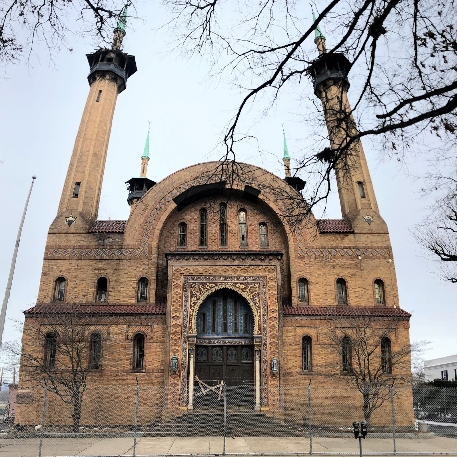
Built in 1907, the former Shriner's Irem Temple is undergoing renovation. Its distinctive features, evoking an Islamic theme, looks incongruous with the surrounding neighborhood, but also attests to a more prosperous era for Wilkes-Barre. The building is currently surrounded by a chain link fence suggesting renovations; however, the broken windows and the haphazardly nailed boards across the front doors suggest otherwise.  


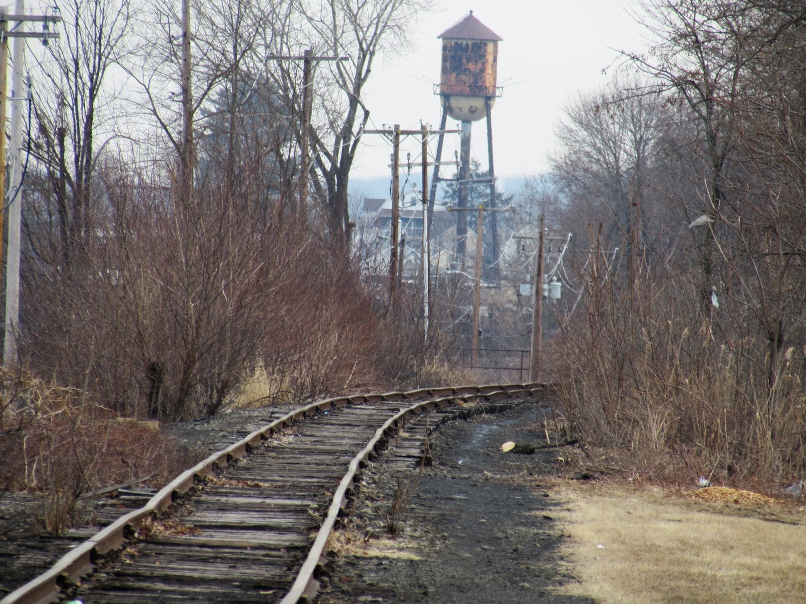
Abandoned tracks leading out of town

Sunday, June 24, 2018

Walking the Royal Canal (Part 3: Supply Canal)


The Supply Canal empties into the Royal Canal near
Harbour Road in Mullingar
At the northern tip of the arc of the canal that circles Mullingar, there is a small tributary canal that feeds the Royal Canal from Lough Owel. The Supply Canal is about half the width of the Royal Canal and originates from Lough Owel, a lake approximately 3.5 miles long and 2 miles wide. The trail is not particularly well publicized, even though it is a beautiful walk and a couple of interesting historical sites along the way.
If you let the threat of rain keep you from accomplishing your tasks, you will never get anything done in Ireland. The night before, a storm including 60-mile-per-hour winds lashed the midlands. The next morning, the winds remained brisk and dark gray clouds rushed across the sky. But it was my last day in Ireland – so I go. Debris from the high winds the night before litter the trail with leaves and branches. The storm had brought in a noticeable drop in the temperature, which was a relief to many of the locals. While many enjoy the warm weather, their houses and businesses are not built for the heat. Walking to the canal, there was the faint smell of peat burning to warm nearby houses; a smell of which I have grown fond. The canals seemed fuller and much of the pollen and debris, which had accumulated on the top of the water over the past few days, had disappeared.
Less than a mile north of the Royal Canal, the Supply Canal crosses Castlepollard Road, a busy thoroughfare with no caution lights to warn traffic about pedestrians. A small sign indicated that there is a Famine Cemetery close at hand. About 100 meters further on, the cemetery sits on the edge of an industrial park. While you cannot see the buildings from the warehouses and factories because of the trees, the associated noise let you know that you are not in a remote area. A small stone gate, with a cross atop, indicates the location of the cemetery. Renderings of the mid-nineteenth century Great Irish Famine are common when traveling throughout Ireland; there are a number of monuments and memorials to those who died. But to see something that is tangible from that period is rare.
Entrance gate to the Famine Cemetery
Approximately one million people, of a population of about 6.5 million, starved during An Gorta Mór. Another 1.5-2 million people emigrated during the late 1840s. While, beginning in 1845, a blight largely destroyed the entire potato crop, the primary staple for most Irish peasants, the island continued to export food. Charles Trevelyan, the official in charge of the British response to the famine, did not want to provide assistance or food relief because he feared that it would adversely affect the natural order of markets. Therefore, landlords in Ireland, primarily British, could make more money selling their crops overseas than providing it to the local Irish population. As a result, peasants in Ireland were not protected against the ravages of famine and starvation. The population of Ireland dropped by fifty percent over the course of the nineteenth century.
Interior of the Famine Cemetery
County Meath was hit hard, but its situation was not as desperate as some of the counties further west. In November 1845, in the nearby town of Moate, a mass rally of 4,000 people called on the government to provide help and subsistence to help the local population. The plea had no reply. At the Mullingar Union cemetery, other than the stone gate, no contemporary markers can be observed. Two stone monuments have been placed in recent commemoration. One describes the people interred at the cemetery, “buried in piles, including some of the workhouse’s 7,000 dead.” Overgrown with grass and trees, it is difficult to imagine the number of skeletons who lie beneath the earth. What is more, it is impossible to recreate the images and smells of a dying population during the Great Hunger.
Since it was a weekday morning I had the trail, other than several animals, mostly to myself. Swallows frenetically skim the small canal, searching for the insects that invariably live near the water. A few song birds made sure to give me wide latitude. The gathering clouds made me wonder if I would reach the lake dry, or even at all.
Saint Brigid's Well
Within another half mile a sign, just past a fish farm, indicated the location of Saint Brigid’s Well (Tobar Brighde), which has been a place of worship since about 700AD. More than likely, originally it had been a place of worship of the Celtic goddess Brigid. A small well comes above ground and runs less than six feet to a stream, which, in turn, empties into the fish farm and eventually the canal. The site was Christianized and, a Stations of the Cross and small chapel were added in the mid-twentieth century.  A sign tells visitor that “Here our forefathers walking in the footprints of Brigid pondered the suffering and death of Our Saviour.” I contemplate that for a few minutes and wonder about the contemplations of those before the arrival of Christianity. What was their hopes and fears? We are likely never to know. I took shelter in the open chapel at the well for a few minutes as a light, but persistent rain shower passed. My presences in the chapel caused much consternation to a pair of swallows who had built a he top corner of the chapel. It is unbelievable that in the space of about ten minutes, the weather completely changed. Blue skies emerged, and I found myself searching the sky for the dark clouds that just a few minutes before were so threatening. The clouds had seemingly vanished.
The rail line between Levington and Cullion 
At this point, the canal went through private property. The canal path ended; but a bike path, running alongside Old Longford Road continued toward the lake. One old cedar tree, on the edge of a field, frown under the pressure of the high winds. Perhaps it is not the rain I should be worried about, I thought, but the possibility of falling limbs. Just before crossing the railroad track, where I briefly observed the Sligo train, a small road to the left, wide enough for only one car begins to parallel the canal again. About a quarter mile from the lake, a stone bridge carries the road across the canal just before it ended at the lake.
Lough Owel
Lough Owel is beautiful and is renown among anglers and birding, provided you have a vessel to set upon the water. Where the canal waters leave the lake, to enter the canal and make its way to Mullingar, is a sailing and boating club. Unlike in the States, there are no other facilities, snack outlets, or gift shops. Recreation is dependent on the individual or a group.
On the return trip, there is a sense of melancholy. It is my last day in Ireland, and Europe, for this year. In just a couple of hours I will board a bus to take me to Dublin Airport. As I walk through the small village of Cullion, whose etymology is suggestive of a contemptible fellow or rascal, where I will cross the railroad tracks and rejoin the canal for the two-mile walk back to Mullingar, I look over into a field where seemingly a million small yellow flowers are blowing in the wind, almost as if they are waving goodbye to me. Already I am thinking of the tasks I must accomplish when I return; the appointments to keep, and the meetings to attend. It is tempting to believe that if we could relocate here, life would be simpler. But I know it is not true. We would trade our current responsibilities and concerns for others. Humans are social creatures, inevitably we develop new connections and new tasks. Nevertheless, it is pleasant to walk these trails, free from our concerns for a few hours; to wander and to explore, to renew ourselves for the journeys to come. 

Tuesday, June 19, 2018

Walking the Royal Canal (Part 2)


On an overcast day, a little over a week later, I returned to Mullingar to explore more of the canal. My ambitions were high that afternoon: to walk from the center of town to a small pub, Mary Lynch’s, approximately seven-and-a-half miles toward the east. The weather was cooler, a pleasant 63°F, and the only demands on my time was the bus schedule to allow me to return to Mullingar at a reasonable time.
The previous week I had walked to where the N52 crossed over the canal and path, approximately a mile-and-a-half out of Mullingar. Thus, tried to move swiftly through the area, and it seemed to take forever to get back to N52. On my previous walk I had been concentrating on birds. This walk I became fascinated with the windflowers and the bees that roamed from flower to flower.

Quickly, it felt as if I were walking in remote areas. Probably because it was a Tuesday afternoon, I saw very few people on the trail. There were several overgrown paths leading from the trail, most were overgrown and appeared not to have been used in quite a while. In Scotland, the right to roam makes it less daunting to explore the odd and intriguing path. The idea is that as long as you are recreating, committing no harm, you can walk virtually anywhere in the wilderness. But this does not apply to Ireland. There are far fewer no trespassing signs, or signs warning to beware of dogs, then in the United States; however, there are some. I overcame my trepidation and took a side path, which was not particularly well marked, up a hill. What did I find at the top of the hill? Nothing more than a field, or perhaps it was a pasture. My curiosity was in unrewarded. Of course, how would it have been rewarded unless I had taken a look?
Marlinstown Bridge
Earlier in the day, at a convenience store in Mullingar I bought a ham sandwich and a bottle of water. The elderly gentleman who sold me the sandwich, said it was a nice day. I retorted it was an excellent day for a walk. A big grin came across his face as he said, “Enjoy the walk, and God bless.” I stopped for my lunch at Marlinstown Bridge, a one-lane bridge in a remote area. Yet, a service truck crossed the bridge and a man and his dog walked by. I wandered to the other side of the bridge and found a trailhead to a wilderness path along the high bank of the canal. A few bug mansions and bee hotels had been built to help promote local biodiversity.

The path opened into a wide valley, where it ran alongside several pastures and farms. I was thinking that I had not seen many aquatic birds along the canal, other than a pair of swans on the west side of Mullingar the week before. Then, within seconds, I spied a grey heron, who did not allow me to get to close to photograph before flying off. Many of the nature signs along the canal touted the multicolored kingfisher as being native, but elusive, to the area. Although I kept looking I was disappointed by not seeing the European cousin to one of my favorite birds. In fact, the crane would be the only aquatic bird I saw during all my walk on the canal.
The N4 highway approached closely, and ran parallel to the path in this area, and it was hard not to be distracted by the noise. I saw another stone marker, which was impossible to read. I noted, however, that today in Ireland every half kilometer is denoted along roads N4 and the stone markers would probably outlast the metal signs that currently gave motorists their whereabouts.
The Downs Bridge
As I approached the Downs Bridge, the path served as a paved one-lane road used by a few houses. At one point, a bush hog mowing the grass along the edge of the road patiently waited for me to pass. I was glad he did. After I passed I heard the mower hit some glass bottles and aluminum cans, the shrapnel would have hurt I am sure. A little bit further, several trucks were repaving the asphalt on the Downs Bridge. An older worker sitting on the back of a truck greeted me. I asked him to confirm that I was the Downs Bridge, which he did. He inquired as to if I were having a good walk but the look on his supervisor's face suggested that we should keep the conversation short.

Here and there houses told stories about their occupants and the land. A white house with yellow trim caught my eye and sparked my imagination. The house had several additions and four rather large pine trees, which looked out of place in the Irish countryside, which were planted a generation ago. The back of the house, typically known as the garden, was full of flower pot and plants. An old sliding board, with faded red paint, was being consumed by grass that had not been mowed in a quite a while, indicating that the children no longer lived there. But a newer, small green table with two chairs overlooked the canal. I imagined an elderly couple taking their afternoon tea or evening drinks while watching wildlife or the cyclists pass.
A hand-cranked drawbridge
Shortly before automobile access to the path ended, I passed a bridge that had an intact hand crank drawbridge that would allow cars to traverse the bridge when down, its current state, and boats to pass when raised. I was mesmerized by this old structure and was thinking about how to describe it. I took several photographs, from different angles, to demonstrate how it worked. In my head, I was imagining a conversation with my dad, trying to explain the design to him, who would have been deeply interested.

Between the Downs and McNeads Bridges, the canal sat high above the valley floor. Several culverts allowed small rivers and streams to pass beneath. Since this section of the canal was completed by 1817, I pondered the work and planning that went into its creation. I am unclear about the conditions under which the canal was built and who did the labor. But It was a reminder that early nineteenth-century canals were a marvel of engineering. I walked between the Royal Canal's successors: to my right was the railroad tracks, which later in the nineteenth century would make the canal obsolete; to my left, the N4 highway that took the modern traveler, whether my bus or car, to destinations throughout the island.
Toward the end of my journey, I realized how glad I was that it was not sunny. Although it was not optimal for beautiful picturesque photographs, it made walking much easier. I was not prone to being too hot or having an Irish sunburn. Besides, the cloud cover did make it easier to photograph some of the wild flowers without shadows. It also made it easier to continue the journey. I arrived at Mary Lynch's pub a full hour and a half before the next bus was scheduled to arrive. I had walked a little over seven miles at that point but did not think that ninety minutes in the pub was a good idea.

A pied wagtail at Lock 25
After a few minutes, I started to slowly walk to the next bridge, another two kilometers further. After a few minutes I resumed my natural pace but was beginning to feel the toll on my feet. When I reached Lock 25 (Loc 25), I decided that it was enough of a walk. My day would end with a total of 9.8 miles.

Mary Lynch's Pub
I returned to the Mary Lynch Pub with about an hour before the bus was set to arrive. I few people were around the bar, and I ordered a celebratory Guinness to pass the time. The bartender, who said she saw me walking earlier, asked me how I enjoyed my walk. I replied that it was a nice day for walking. She gave me a detailed summary and update of the weather, noting that previous week had been too hot for many people. The pub had had several walkers and cyclists who could not cope with the extreme (for Ireland) temperatures.

Mary Lynch's Pub
The bartender told of a woman who, while cycling with her husband the previous weekend, got cramps and light-headed. Her husband gave her a "fiver" and rode his bike home to retrieve the car. An hour and a quarter later he came back. One of the women at the bar comment, "An hour? She needed more than a fiver." The bartender went on to tell me that, "High pressure will be building tomorrow night and will be turi-bill winds. It will blow itself out by Turs-day morning. Sunny weather then, but cooler." Her forecast was pretty much right.

She took care of other guests and nursed my beer. I went out to catch the route 115 bus at 17:52, five minutes early. Even though I knew the stop was near the end if the route and it highly unlikely to be on time. After walking nearly ten miles, I neither wanted to miss an on-time bus nor consider a 7-mile walk back to Mullingar. I have been riding buses in Ireland for over 15 years and feel confident about understanding the nuisances of doing so. But I have to admit, with my feet aching, watching cars zooming by coming home from work, when the bus was twenty minutes late I began to have some doubts and trepidation. But when the bus rounded a bend in the road, thirty-three minutes after its scheduled arrival time I was happy to pay my €4.30 to return to Mullingar.

Sunday, August 16, 2015

A Short Road and Rail Trip

A short road trip found Spence and myself spending a night in Lock Haven, Pennsylvania. After spending the day roaming rural Pennsylvania, checking out the Pennsylvania Grand Canyon and the Wellsboro Diner, we headed for an evening of baseball and adventure. In our brief time in the area, we found good food, conversation and interesting things to think about.
A home for the night
Sometimes the adventure of travelling is not limited to where one visits, but often where one lays their head. This trip had us staying in a caboose, constructed by the Pennsylvania Railroad in 1941. It is now owned and operated as B&B (without the breakfast) by the Clinton County Historical Society. The caboose rests at the old railroad station in Castanea, a small village just across Bald Eagle Creek from Lock Haven. It had the amenities of a nice self-service hotel room, with a dining area, refrigerator and microwave, plus the added bonus of great nostalgia. Although trains no longer pass through the small village, and most of the tracks have long since disappeared, as you wake up one can still hear a constant stream of train whistles in the distance, punctuating the quiet early morning. At one point I thought to myself, is this what it would be like to ride the rails? 
A minor problem with staying in the caboose was that I did not bring a towel, something not provided by the historical society. Thinking I might like to have a shower the next morning, we stopped by a dollar store to purchase a lime green towel ($2.50) and matching washcloth (.50). The next morning, after taking a shower, it seemed that the towel had left a great deal of itself on the floor of the shower. The rest of the day I felt like I was picking lime green lint out of my hair and off my clothes.
A bed for the night
My travelling partner has a propensity to sleep late, so I took the opportunity to have a short walk to explore Castanea. After a night of rain, clouds hung low over the mountains as I walked. The town has become a bedroom community of working-class people, with older homes and very few businesses. There was one house, at the corner of Logan and Brown, which has been abandoned for some time that made me think of the old mansion in the film, It’s A Wonderful Life. Not that the house necessarily resembled the abandoned film mansion; however, the broken windows and the two stories made me wonder if local people might believe the house was haunted. The streets in the town resemble the lattice-work of a pie top, nestled between Bald Eagle Mountain and Bald Eagle Creek. A small, fast-flowing stream, Harvey’s Run, bisects the town from the mountain to the creek. It was running quite heavy after a night of rain.

After my perambulation I find myself at the Train Station Restaurant, a thriving enterprise. The restaurant occupies what once was a house. Two women ran the breakfast without pretense. The food was simple but good and informal. An egg, toast and a cup of coffee cost me less than $4.00, meanwhile I was privy to many of the conversations between locals. The waitress kindly laughed at my joke that I might be back for a second breakfast when Spencer woke up. Sure enough, about 45 minutes later, we returned to the restaurant and I had yet another cup of coffee and toast while Spence had a hearty breakfast of waffle and bacon.


Tuesday, July 28, 2015

East Broad Top Railroad

Narrow-gauge track in Three Springs
The East Broad Top Railroad line, a defunct, narrow gauge line, is still observable in Three Springs, Pennsylvania. At its peak the company, which built the mainline from Mount Union to Orbisonia between 1872 and 1874, owned 60 miles of line. Its primary function was to remove coal from the Broad Top Mountain plateau. From the late 19th century until the 1950s, the line hauled coal. With the precipitous fall in coal prices and the switch to oil and gas, the railroad switch to tourist excursions from 1961 to 2011. Although there is a preservation society, it appears that excursions have not ran for the last four years.

Squirt Soda advertisement
On a trip through Three Springs, I took the opportunity to photograph the line and a railroad building with a (seeming) vintage advertisement for the soda Squirt.


Monday, November 10, 2014

On the occasion of your 106th birthday

I have been thinking about you a lot lately; it has been a little over 25 years since you died. Many of the things that you might have recognized are no more. The church building that you loved and nurtured is still standing; however, the congregation that you knew has been disbursed. The buildings of the railroad where you toiled in a lifetime of work are still standing, but the company has long since been bought and it is now part of a major international corporation. Sadly your son is no longer with us; however, your grandsons and your great-grandchildren thrive and are happy.
Even though you are no longer with us, you are in my mind. You are still a role model, especially when it comes to treating people with kindness and patience. Your memory reminds me that quietness and thoughtfulness are not vices; they are comforting to those around us. It is those who are patient and kind get the most out of life. Greatness is not found in grandiose awards, but in the simple recognition of your friends and neighbors. 
You once told me, a couple years before you died, how much you enjoyed your travels. I still remember long drives on Sunday afternoons in the country, just exploring. We were seeing what was “around that bend” or “over that hill.” Your one travel regret, you said, was that you never had the opportunity to visit the land of our ancestors, and of your mother: Germany. I have been there and I am lucky enough to visit often. You should know it is interesting and beautiful and you would have loved it. On the day before your first birthday after your death, momentous events in Berlin changed the world. It was remarkable and I remembered you that evening. All these years later, I continue to think of you often and especially every time I find myself in Germany. 

Happy birthday, Fred. 

Saturday, October 11, 2014

My Life with Trains (Part 2) Nostalgia

I grew up in a railroad family; both my father and my grandfather worked for the same small railroad, the Kentucky & Indiana Railroad, better known as the K&I. Before the final sale of the K&I in late 1981, my dad transferred to the L&N (Louisville and Nashville Railroad). Both of these railroads are no more. The L&N as a separate entity disappeared into the larger corporate name of CSX. The fortunes of the K&I, its workers and my grandfather were key topics of discussion in my early childhood.
Although the yards of the K&I are still in the Portland section of Louisville, the only substantial reminder of the old company is a railroad bridge, the K&I Terminal Bridge, from Portland to New Albany, Indiana. When I was growing up, we would often cross into southern Indiana over the bridge. I often remember it as a nerve-racking adventure. The bridge was high and the paths for automobiles were narrow. It seemed that there were only inches on either side for the car to pass through the blackened steel fences.
Lady watching the model train around our
Christmas tree (still from family 8mm film)
From my young perspective, the best thing to come from that old railroad was a dirty old dog. I do not actually remember it, but the family legend was that my dad called my mother and asked if it was alright to bring her home. When she arrived, the dog, which had been hanging around the yards for a few days looking for food was filthy. It took several baths to clean the oil and soot out of her fur. That dog, despite her humble beginning, would go on to become one of the legends of family. Given the name Lady, she became very protective of me. She climbed on top of my toy box each night and waited for me to go to sleep before creeping out of the room, signaling my parents that I was, indeed, asleep. She was a trusted, and loved, member of the family.
On another occasion the K&I yards offered an abortive miracle. My father, the religious man he was, was transfixed and perplexed by a question my brother once asked. We have driven down to the K&I yards so that my father could speak with my grandfather about something. (Perhaps it was a ruse to get out of the house) It had been a longstanding practice to see my grandfather at work. He was kind and always glad to see us; however, on this day, my brother and I were told to sit in the truck (a 1950 Ford Pickup) and wait because it was too dangerous to go in to the shop where my grandfather worked. While sitting there I asked my younger brother if he had noticed the little plastic crucifix that was propped up on the side of the building.
When my dad returned my brother asked, “Can we go around to the side of the building and see Jesus?” The look on my dad’s face was enough to tell me what he was thinking. Either that his young son was having visions of the Christ appearing at, of all places, the rail yards of the Kentucky & Indiana Railway, or he was having hallucinations with religious overtones. Either way, this was something monumental. I relished the moment for a split second. I enjoyed the confusion; the irony of something mundane being mistaken for something extraordinary. But in an instant, my dad gave me a look. All of the sudden I was being considered with suspicion. What had I done or said to lead my brother to assume that Jesus was inhabiting the side of a building at the K&I? My father’s stare became more focused on me, “What the hell is he talking about?”
I explained that there was a plastic crucifix on the side of the building where my grandfather worked. My dad drove around to look at it, one of the arms, the right one if I am not mistaken, was missing – probably broken off after a fall. My brother asked if we could have it and dad replied that he would rather buy us one. This one had been exposed to the elements and coal soot, and was broken.
Abandoned rail line behind the library in Lewes, Delaware
The disappearance and history of railroads continues to interest me. Although one of the great nineteenth century inventions, its utility and allure continues well into the twenty-first century. Railroad archaeology, abandoned stations, former right-of-ways converted into paths for walkers and cyclists, and historic excursion rides are all evidence of the profound effect the railroad industry has had on the modern world. For me, it is a reminder of a bygone, yet personal, past that evokes a great deal of nostalgia.


Friday, August 8, 2014

New York Central Railroad Station (Rome, NY)

Located on Martin Street, the train station in Rome was built between 1912 and 1914. The station was necessitated when tracks were realigned in the city and replaced an older station downtown. Currently, the station is served by Amtrak.

Restored in 2004, the interior of this lightly used station is beautiful. Many of the original (or at least old) features have been preserved. The wood benches that are fixtures in many stations look pristine. Signs direct patrons to services, such as newsagents and subways, that are no longer available. Overall, the station is a portal, not only to other places, but to a time when Rome was larger and more prosperous.  


Thursday, June 26, 2014

Hidden New York

In New York, sometimes it seems that real gems are obscured by the obvious. Earlier this month, I was interested by all the people milling around the 9/11 Memorial Site. The recently opened site intends to honor the victims of that terrible September morning in 2001, complete with an office tower and a shopping mall. Virtually every tourist was taking the same photograph, over and over again, from the same perspective, of the newly completed Freedom Tower. I did not see anyone who noticed the architectural gem at 90 West Street, which was damaged during the 9/11 attack as well. The building opened in 1907 and was designed by architect Cass Gilbert. The primary tenant was the Delaware, Lackawanna and Western Railroad and it also housed Garret’s Restaurant, billed as the highest restaurant in the world at the time.  Its magnificence is obscured by other tall buildings and the distraction of other sites in lower Manhattan.

Sunday, June 1, 2014

Shannon Bank Nature Trail Walk

The trail near Magazine Road and Cherryfield Avenue.The By-Pass Canal is visible in the foreground, while therailroad tracks and abandoned buildings, once associated with the former Midland Great Western Train Station,is in the background. 
This five kilometer trail begins on the west bank of the River Shannon, eventually meandering along the Athlone By-Pass Canal (constructed in 1757) and ends in the Big Meadow (An Chluain Mór), along the shore of the Shannon just south of the city.  While the trail skirts the west end of the city, and traverses several neighborhoods, for the most part it is a peaceful and relaxing walk with many opportunities to see birds and wildlife. The primary objective of the trail is to highlight the natural beauty of the area; however, there are several human enterprises that catch the eye as well. The trail takes the walker by the famous railway bridge that traverses the Shannon, pretty houses and interesting neighborhoods.

A Moorhen roosting on a rowboat along the canal. 

An unidentified bird along the shores of the Shannon

A fellow traveler on the trail