July
On a Friday evening, I lectured to a group of students from
Europe on the politics of walking and the history and culture significance of
the Appalachian Trail. In such lectures I highlight the restorative mental
health mental benefits of walking/hiking, and then note that such activities
can be difficult for many to enjoy because of discrimination, social stigma,
and the barrier of transportation. Two days later, I led the group of about two
dozen on a short one mile out, one mile back on Big Pine Flats, from
Shippensburg Road. It was a beautiful, but sticky morning, and as we started
down the trail I had many questions about hiking, walking in Europe and the
United States. A woman from Finland regaled me with stories about hiking and
gathering berries in the wilderness; a young man from Spain was encouraging me
to walk El Camino. As we neared our turnaround point, I was in deep
conversation but could not help but notice that the skies were getting darker. Within
minutes of beginning the return trip it began to rain. A gentle, steady rain
turned into a deluge. There was no way around it, we were all going to be
soaked. I was a little worried about how the group was going to take it. But to
my relief, as the rain came down at its hardest, many in the group began
singing the chorus to, “Here Comes the Sun,” a reminder of the importance of
music and group activities. In the following days I saw many of the students on
campus and at various events. Several told me what a great time they had on the
hike, and how much fun it was to see a small portion of the Appalachian Trail.
 |
| Students hiking on the trail |
A few days later I was driving to the Rocky Knob parking along Ridge Road, an unimproved forest road, primarily gravel, that is the backbone of transportation on South Mountain. Unlike many other forest roads in Michaux State Forest, Ridge Road is extremely passable and easy to use. While not a road most people would accept in a village or town, it is comparatively heavily trafficked. A doe and fawn ran across in front of me just as I was pulling into the parking area. After my walk, a pair of wild turkeys sauntered across the road as I was pulling out of the parking area. It is probably why so many people just take a drive up to Ridge Road. It is a place where one can glimpse wildlife from the comfort of one’s car.
Accessing the Appalachian Trail from the Rocky Knob trail, I
heard a persistent chirp, unfamiliar, according to my app it was a hooded
warbler. I stood and tried to find it, thought I caught a glimpse of it, but
ultimately unsuccessful in identifying it. It remains off my bird’s “life list”
because I have not seen it yet. We all have our own personal rules about
collecting and cataloging.
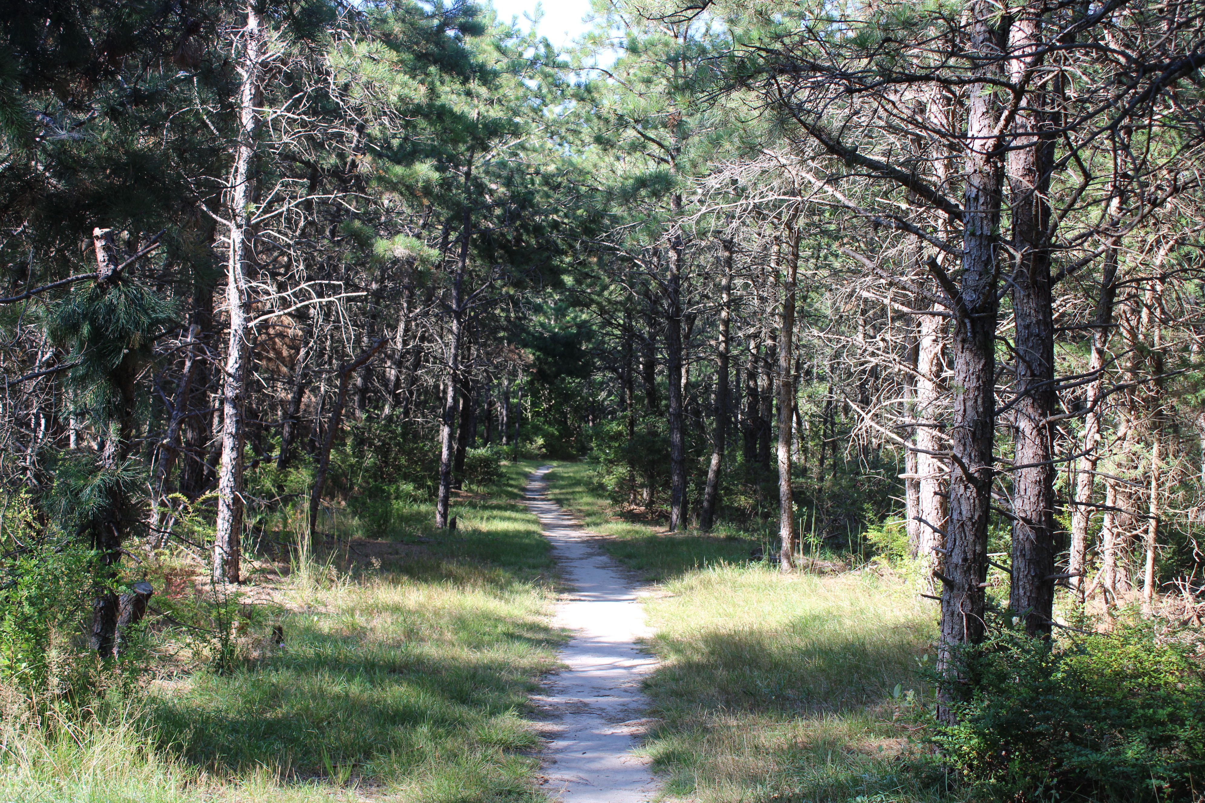
I am particular to pine trees, especially groves of pine
trees. The smell of the trees and the sound of the wind through the pine
needles is evocative. It drowns out all other sounds, creating a white noise
and focusing the mind on the present. During the winter, the sound of whooshing
sounds like cold to me. (old movies) The tactile feel of crushed pine needles
while walking is especially appealing. If you step off the trail and walk among
a stand of pines, the needs cushion your walk. The trees, even though the
needles are so thin, provide enough shade that nothing grows beneath.
 |
| Pine thicket between Rocky Knob Trail and Ridge Road |
I have fond memories of camping in the pines at a scout camp, called Horine, in the Jefferson County Forest outside of Louisville. If one did due diligence by moving the branches and pinecones, the needles offered a comfortable mattress for a night’s sleep. In the winter, they provided insulation. But the novice who tried to keep a fire going with pine needles produced a lot of smoke, and not much heat.
The problem with getting to Milesburn Cabin, at least on
foot on the Appalachian Trail, is that it is a steep descent from either
direction (Means Hollow Road or Ridge Road). Walking south on the AT, crossing
Ridge Road, steep decline. I spent most of the time thinking about having to go
back up the hill. I judge myself to be in reasonable shape for a person my age,
but I do have to stop for a rest if the hill is particularly steep. About
halfway up from the cabin to the road, I am breathing hard and feel my heart
pounding in my chest. With temperatures in the low 80s, I am moist all over from
perspiration. “Is this worth? Is it what I should be doing,” I ask myself.
 |
| Milesburn Cabin |
Half a mile from the car, I hear distant, but persistent, thunder. It is isolated showers, but strong enough to make me abandon any thoughts of going further this day. The oncoming weather system portends a change in the weather for the worse. The merciless heat that has been punishing the southern part of the United States is finally making its way north. Record high temperatures for the date are set to follow in central Pennsylvania. It will likely be several days before I return to the AT.
Driving on Means Hollow Road, a steep, unimproved road, can
be harrowing especially when confronted with on-coming vehicles. On the side of
the road, the erosion ruts are deep enough that I would worry about getting my
Subaru Forester out without relying on a tow truck or wrench.
It is a beautiful but hazy day. The haze, not all that
uncommon for central Pennsylvania comes come either pollution or smoke; either
way it is not good. The wildfires in Canada has had a dramatic impact on air
quality in the Northeast this summer. I missed the worst stretch of wildfire
smoke in June, but the accounts were grim. A dense fog of smoke and haze
settled over the Cumberland Valley, and elsewhere, leading to days of low visibility,
closed windows, sequestering inside, and concern about the respiratory health
of friends, family, and pets.
I found a quarter while walking on the trail. As a kid it
was always exciting to have a “found money” experience, no matter how small the
amount. Finding some money on the ground could mean some candy or a drink. As I
got older, it became more of a curiosity. While a graduate student in Oxford,
Ohio once, I picked up a penny walking to campus. It turned out to be an Indian
Head penny from the 1880s. With the use of credit cards and electronic
payments, it is rare to find money on the ground. At some point there were
likely hikers who would have carried a quarter just in case of making an
emergency telephone call from a pay phone – something that no longer exists.
Many of my female friends were told to always carry a quarter in case of an
emergency. Today, mobile phones, GPS watches, and other devices have rendered
that advice archaic. There is not even a pay phone at the general store at Pine
Grove Furnace, much less anywhere else along Section 13 of the AT.
As I walked farther south on the AT from Stillhouse Hollow
Road, the trail seemed more remote, and I saw a lot fewer people. Even during
the hottest afternoon, I come across deer who are as startled to see me as I am
of them. The power lines that run up and over the mountain crackle with
electricity as I walk beneath. It is eerie and haunting.
There are many quiet places along the trail where there is
no sound except the wind and distant overhead airplane. Then, suddenly, come
upon a place where there are a ton of birds all busy and alarmed that a human
has intruded on their solitude. Maybe because there is an opening in the canopy
that allows for good hiding places close to the ground.
There are several strands of dead white ash trees in Michaux
State Forest. Several places along the trail, one walks through a dead stand,
victims of the Emerald Ash Borer an invasive species that is devastating the
species. The snags, stand of dead trees, are visually captivating. and will
last up to a decade before the weather and forest reclaim them. In the
relatively nearby Chesapeake and Ohio Canal National Historical Park, about 67
percent of ash trees had perished by 2021; in Manassas Battlefield Park, 92
percent.[1]
Because of recent forest fires around the world, including the fires in remote
northern Canada and the fire in Maui within weeks of first recording the white
ash trees in my journal, I ponder the possibilities of a fire on South
Mountain. There are periodic control burns to minimize the risk and potential
damage. But most of us along the east coast of the US do not really think about
what a massive forest fire might look like. I suspect most politicians do not
either. Invariably, my mind wanders back to the “Finns rake the forest”
controversy in 2018.[2]

Dead ash trees
Just north of Quarry Gap Shelter, a scree full of rocks covered in lichen. A blue jay silently plays hide-and-seek with me. Normally, it is a species that is quite loud and boisterous but perhaps this one did not expect to see a human.
About halfway through the long climb back to Stillhouse
Hollow Road, a doe jumped out and crossed the trail about 15-20 yards ahead of
me. Deer are plentiful in this area of South Mountain, that is probably why
hunting is popular here during the fall. On my drive up to the trail, as my car
slowly navigated the gravel road at 20mph, a doe looked at me from the edge and
judged she could make it across safely. I continued to be cautious, and as I
got closer, I saw her fawn desperately trying to figure out how to catch up to
mom. Later, another deer startled me while on the trail. It jumped out and
crossed the trail just about 25 yards ahead of me. I grabbed my camera in case
a fawn, which typically has their spots this time of year, was close behind. I
waited for a few minutes, but it was to no avail.
Two things in this area remain to ponder and research: Why
is it called “Methodist Hill”? Why “Haunted Hollow Road”?
Mid-August
After a two-week sojourn in Upstate New York, I resumed my
exploration of section 13 of the Appalachian Trail in mid-August. Typically,
one of the hottest times of the year, the two days after our return were in the
70s with beautiful blue skies. I had a replacement pair of Keen hiking boots,
purchased in Skaneateles, which contrary to the advice that they need
“breaking-in” are surprisingly comfortable. Hiking boots are one of the
expensive accoutrements of hiking. Technically not absolutely necessary,
but close. The rough terrain of the AT makes high quality hiking boots very
desirable. Since I need to replace my pair every 900 miles or so, I am buying a
pair about every six months.
My starting point is Quarry Gap Shelter for the walk into
Caledonia State Park to finish the southern half of Section 13. It is the only
part of the trail that I am not doing an out-and-back. Angie drops me off at a
remote location on Quarry Gap Road so that I can meet the Appalachian Trail.
Shortly after she pulls away, an older man asked me directions to the reservoir
from Locust Gap Road. He said that he used to run from here to there and was
the Locust Grove Trail what he should take. I did not think so, but confessed I
was not sure. I tried to show him the map on my app, but the connection was
bad, and I had only downloaded the area where I was walking. He was dismissive
of technology (and I understand). He
called me “brother” several times over the course of our conversation – I took
this to mean that he was once, or still is, a hippy. I like the term, sometimes
I think we should use it more in our daily conversations.
 |
| Decoration at Quarry Gap Shelter |
It is a tough descent into, or ascent out of, Caledonia State Park. Once in the park, it is very nice. The trail meanders through a scree, with lichen-covered rocks and small tributaries of water. The pine trees overhead trap the moisture, so the mosquitoes are persistent even if my repellent prevents bites. But arriving at the state park is a relief. The State of Pennsylvania acquired the land for the park in 1903 and soon a trolley line ran from Chambersburg to ferry people for leisure. More than a hundred years later, Caledonia remains popular. On a summer Saturday afternoon in August find the park filled with people picnicking, swimming, meandering, and playing in the creek. The AT crosses a bridge for Conocoheague Creek and then Trolley Car Trail. Section 13’s southern terminus is a daunting crossing of US Route 30.
 |
| Crossing Conocoheague Creek in Caledonia State Park |
 |
| Trolley Car Trail |
The beginning of each semester is stressful and a little sad. It is a reminder of all the things, both personal and professional, I did not do during the break and a realization that I was soon to be flooded with new tasks to perform. A last long walk before the start of the semester is ritual. An acknowledgement that my discretionary time is changing and a chance to find some serenity before the deluge of meetings and responsibilities. I returned to Shippensburg Road and began the journey northward toward the northern end of Section13, Pine Grove Furnace.
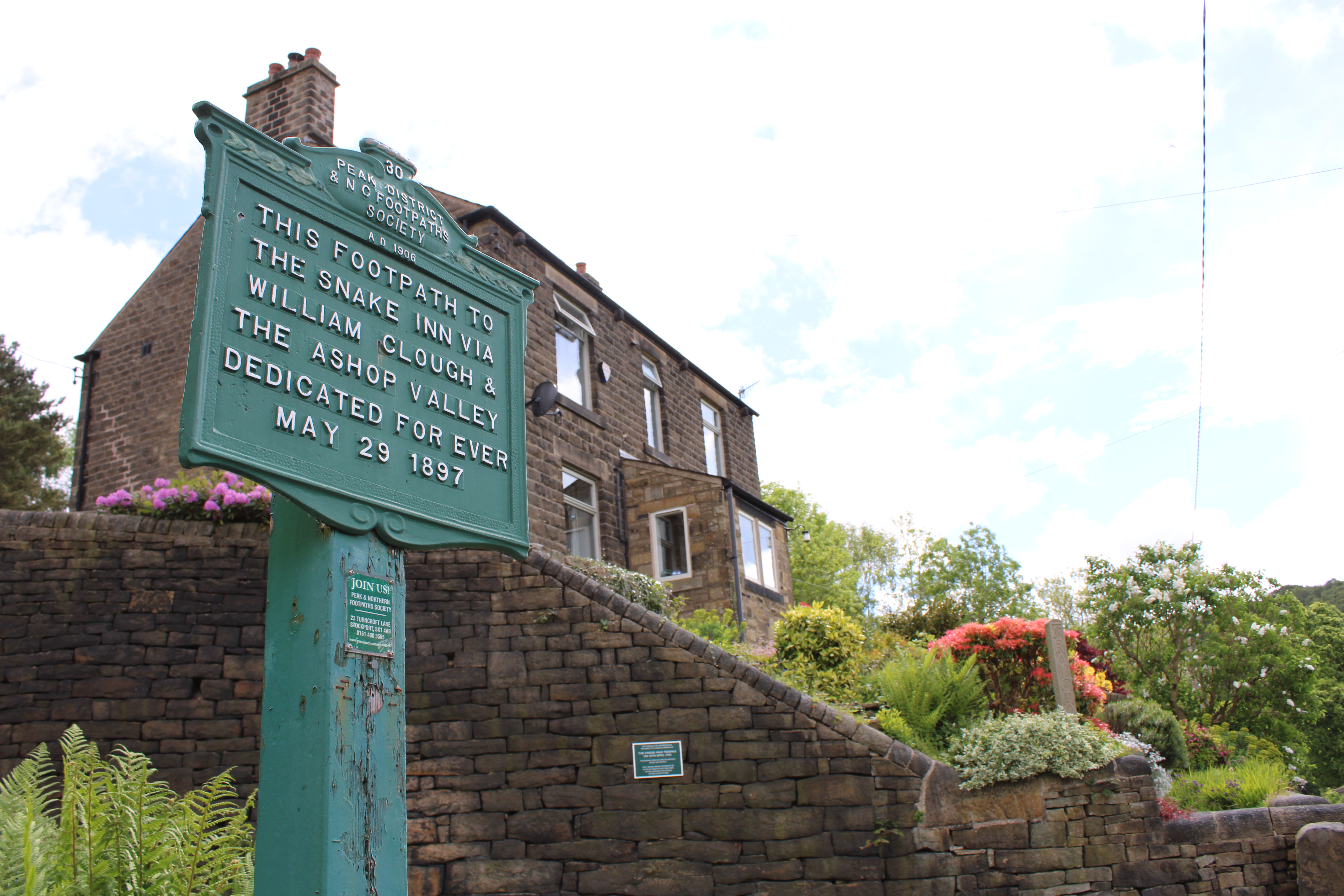
Many people access the trail from the parking lot on
Shippensburg Road; it is convenient with an iconic sign. The walk north is
relatively easy for the first mile or so, through a pine thicket and across a
nice creek. About half a mile in, the halfway point of the AT is denoted. That
demarcation is a bit fluid because the trail changes yearly. But within this
area, through hikers know that their journey has reached a milestone. That
which is common to us, we often do not pay attention to. For example, I often
hear something rustling along the trail, wait and watch in expectation, only to
find that is just a grey squirrel. Somehow, I still marvel at white-tailed deer
or a common bird species, but a lowly squirrel, who often robs the birdfeeders
in our backyard is not afforded the same attention. Yet, on this day, I Identified
a large squirrel nest at the top of a tree, something that is easy to do in the
winter, but they are well-camouflaged in the summer.
Walking near Dead Woman Hollow Road, a name that prompts
consideration, I heard voices behind me having rather loud conversation. I sped
up, thinking I could divert onto the nearby road and allow them to pass. Just
as I did, however, I saw something rather large fly along the trail and then
off to the left to land in the treetops. Assuming it was a hawk, I crept up to
a spot to reconnoiter. Perfectly framed between two branches was a great-horned
owl, it saw me, but I slowly reached for my camera and aimed, the automatic
focus just coming into clarity when someone ran up beside me and said and
excitedly, “What is it?!” The owl flew off before I could press down for a
photo. As the National Wildlife Federation notes, the great-horned is one of
the most common and widely distributed owls in North America, but because they
are nocturnal and excellent at camouflage, they are rarely seen.[3]
She said to me after the bird flew away, in a softer voice, “Ooh, sorry. What
was it?” But her friend, who was somewhat behind, was yelling, “What is it?”
too. We exchanged pleasantries, but I was disappointed. One of the women said
as they moved on, “Have a good hike!” I wanted to reply, “How is that possible
now? I am going to be thinking of that owl the rest of the hike.” But
begrudgingly muttered something to the effect, “you too.” The two women hiked
merrily away. I slowed down, meandered around the trail a bit, desperately and
unrealistically hoping for a return of the owl, but more so to let them get far
ahead of me.
Beyond Dead Woman Hollow Road, there is an area that has had
a recent controlled burn. Very few tall trees, but quite a bit of ground
vegetation. It is a pleasant walk, with beautiful crystal blue skies. It is an
unusual August day in that respect; most of the time August days can be very
hazy in central Pennsylvania. My birding app tells me that the bird song I hear
is from red-eyed vireos but I cannot see them. I caught up to the two young
women who I encountered where the trail that leads to Anna
Michener Cabin, a retreat built in 1966 in honor of a long time supporter
of the Potomac Appalachian Trail Club, diverges
from the AT. They were resting, I kept walking toward the cabin about a quarter
mile farther. It will be where I will leave off for a few weeks until I can get
the semester underway.

Anna Michener Cabin
September
It has been hot. Typically, in early September it can be
very warm, but to have five consecutive days of highs in the 90s is not normal.
One evening I walked in the neighborhood at about 8PM, roughly half an hour
after sunset, and it was 84°. I have been working on a project,
where I could use a mental break, take a walk, and it has been too hot just for
a fifteen-minute walk during the day. I have missed the long contemplative
walks of the summer. I imagine why this is why the beginning of the academic
year can be particularly difficult.
The end of summer is quickly approaching on South Mountain. The
black gum trees have begun to turn to red; some sassafras trees have followed
suit. I am starting at Michener Cabin and working my way north. It is a Friday
afternoon, the weekend after Labor Day, with a threat of rain, which holds off.
There are dirt bikes on the forest roads, occasionally disturbing the peace of
the trail but I met no one on the trail.
 |
| Black gum tree |
Most of the northern part of Section 13 is best accessed by Ridge Road, the primary forest road through Michaux State Forest. There are a myriad of accessible roads and what I refer to as “ghost roads,” outlined, rough roads where logging truck might have once traversed. It is easy to get confused in what it not quite wilderness, but out of reach of cellphone service and immediate help.
Along several of the forest roads atop South Mountain, there
are plenty of milkweed plants. That is the plant that is essential to the
monarch butterfly life cycle. In September, monarchs are not hard to find
around southern Pennsylvania but as their numbers continue to decrease, I have
been more conscious about increasing rare sightings. I once could walk out to
my backyard this time of year and wait. Eventually, a majestic monarch, taking
a circuitous flightpath would eventually alight at one of our butterfly bushes.
The last couple of years, however, that has not been the case. Driving on Ridge
Road a monarch fluttered in front of my car. I slowed down, just as I would for
any animal. But there is a sense that I am seeing something increasing rare
too.
 |
| Milkweed plant |
I examined the milkweed plants, usually in vain, for signs of monarchs. But found instead a world of other creatures. Not many creatures are able to feast on the plant. The sticky white substance that gives the plant its name is toxic to most, hence the insects one finds are highly specialized. My initial thought was that the insects that I found on the plant, like milkweed bugs, would be in competition with the monarchs. But the insects use the plants at different times and different stages.[4] While I did have trouble finding any monarch caterpillars, I was able to locate a few milkweed tussock caterpillar, which will eventually become a milkweed tiger moth. These interesting “hairy” caterpillars, strikingly black, yellow, and white, contradictorily emerge into rather moth with large wings that hide an orange-colored torso with black dots.
 |
| Milkweed bugs |
 |
| Milkweed tussock caterpillar |
Snakes are often misunderstood, and although I give them healthy respect, I am always on the outlook for them. I have seen timber rattler on the Appalachian trail, in fact one scared Cody immensely several years ago. He ran off so hard and long, I was worried I was not going to be able to find him at first. More commonly found in this area is the black rat snake. A rather docile creature that often looks like a downed tree branch across the trail. I had not seen any while on the trail this summer until I came across two, on consecutive days, the second week in September. It was humid and hot when I was near a damp, narrow place on the trail, in my mind asking why I was hiking on such an uncomfortable day, when I saw something on the trail. As I glanced down, I realized what I was stepping near, and I jumped back more in concern that I was going to step on it than in fear. When I jumped, it recoiled in horror. It ruined our moment, and it did not want to stick around for a photo session. The next day, I had more of a warning. It was on an old forest road near halfway spring. I knew instantly that the familiar squiggly branch was a rat snake. Rain was impending, but I took some time to take a couple of photographs as it meandered across the road. I like to think it too was look for shelter before the evening showers began.
 |
| Ratsnake |
Walking through the woods and meadows of the Appalachian trail, I have seen an increasing number of spotted lanternflies, the dreaded invasive species that threatens to decimate orchards, lumber, and other agricultural industries. The insect was first discovered in Pennsylvania nine years ago, in 2014.[5] Since that time, they have become increasingly common. The initial message to people was that if a lanternfly was spotted, one should immediately kill it, “if you see it, squash it.”[6] But hikes on the Appalachian Trail in 2023 have demonstrated the futility of that strategy. As I walked near Camp Michaux, I would take a step and a cloud of twelve to fifteen lanternflies would jump and fly out of the way. Another five paces or so, the same thing would happen again. The invasive species, and the associated problems, might be endemic soon.
Ruby-throated hummingbirds are plentiful in the eastern United States but are difficult to discern while walking in the woods. They are elusive and small, darting through our peripheral vision so that we are not sure if we have seen the small bird, or it is a rather large insect. Walking through a semi-remote area of the trail, on a Sunday afternoon, I spotted a hummingbird hovering about two feet above a large patch of jewelweed, eyeing me warily. It was a momentary encounter. I slowed down to observe, and the bird meandered away slowly, probably to find another succulent blossom and avoid any danger I might pose. Jewelweed, or spotted touch-me-not, are quite common during the latter half of the summer. Growing in shaded areas, the bright orange flower is delicate and interesting. With several pollinators around, a patch of jewelweed is always a place to stop and look for something interesting.
 |
| Jewelweed |
We can observe hummingbirds more closely at the feeder that is just outside our dining room window. They are compellingly fierce birds, continuously defending their feeders. I am certain that there is a nest in our apple tree just a few yards away from the feeder. While there is a temptation to see if I can find their small nest, disturbing it would not be the neighborly thing to do. But as the weather turns cooler, and the hummingbirds head south, I will have a look to see if I can find the tiny nest before it disappears from the ravages of winter.
I completed the last portion of Section 13, from halfway
Spring to PA 233 near Pine Grove Furnace, on a bright and sunny Friday
afternoon in mid-September. Autumn in Central Pennsylvania is glorious and many
people, sensing a relief from the summer’s heat and the joys of brightly
colored forest were enjoying the weather. As I walked, although I had to pay
attention to the rocky path, I found my mind was drifting in tangential
exploration of ideas and whimsy.
Less than fifteen minutes into my ascent toward Camp
Michaux, I met two hikers coming the opposite way. As the path was rather
narrow at that point, and they were on the descent, I stepped to the side to
let them pass. The two women, who were obviously on a long walk, stopped to ask
how far they were from the park. I typically do not initiate conversations with
female hikers because I do not want to inadvertently seem creepy and add any
stress or concern to their outing. Not far, I casually said. The women who
appeared to be more tired asked wearily, “Can we make it in an hour?” They were
much closer than they realized, I got my phone out to make sure, but they were
only 0.6 miles from the general store at Pine Grove Furnace. The other woman
suggested that they could slow down a bit; obviously someone was meeting them
for a pickup.
As I neared PA 233 on my return trip, the shadows getting
longer and the sun dimmer in the late afternoon, I passed through an area where
at least a hundred common grackles were roosting. For those of us who have
grown up with Hitchcock movies, it is a bit unsettling sometimes. But they are
likely getting ready for an autumn migration, albeit a short trip perhaps for
these birds.
Walking back into Pine Grove Furnace, the general store
where through-hikers traditionally eat a half gallon of ice cream to maintain
weight during their long walk on the AT is closed for the season. The sun, low
in the sky in mid-September, is shining brightly off the historic stone
buildings in the park. The parking lot was not busy, but was bustling with
people meeting each other, preparing for a weekend hike, getting rides, and
meeting one another. The time of day seemed appropriate for finishing the section,
and the activities observed were emblematic reminders that the trail never ends.
 |
| The Appalachian Trail Museum at Pine Grove Furnace |
[1]
Crystal Chen, “Ash Tree Update 2021,” National Park Service, https://www.nps.gov/articles/000/ash-tree-update-2021.htm.
See also: https://emeraldashborerinsouthdakota.sd.gov/PDF/How-To-Identify-an-Ash-Tree-Infested-by-EAB_06-2001-2018.pdf.
[2]
Martin Belam, “Make America Rake Again: Finland baffled by Trump forest fire
raking claim,” The Guardian, 19 November 2018, https://www.theguardian.com/us-news/2018/nov/19/make-america-rake-again-finland-trump-forest-fire.
[3]
National Wildlife Federation, “Great Horned Owl,” https://www.nwf.org/Educational-Resources/Wildlife-Guide/Birds/Great-Horned-Owl.
[5]
“Pest Alert: Spotted Lanternfly (Lycorma delicatula),” United States Department
of Agriculture, August 2019, https://www.aphis.usda.gov/publications/plant_health/alert-spotted-lanternfly.pdf
[6]
Rachel Ramirez, “Spotted lanternflies are thriving in the Northeast. Scientists
fear they could spread farther,” CNN, 24 September 2022, https://www.cnn.com/2022/09/24/us/spotted-lanternfly-habitat-expanding-climate/index.html.