Thursday, June 5, 2014

Moate Hill Road

I was examining my map, looking for interesting walks in and around Moate. I noticed Moate Hill Road, which was not immediately on my list, but it did go south and all of my previous walks had been on the north side of the city. Upon studying the map further, I had difficulty determining where the road actually was. According to my map, the road started directly across from my hotel (Grand Hotel, Moate); however, at first glance, I did not see it. This, in fact, sparked my interest and it turned out to be one of my favorite walks of the trip. The road was, indeed, right in front of the hotel, situated between two buildings. To an American set of eyes it looked to be a private drive. As I traced the route, I thought it was also interesting that the road crossed the M6, the major highway between Dublin and Galway.
The beginning of Moate Hill Road
Moate Hill Road starts between two buildings in the center of Moate, Walshs clothing store and a currently disused building that was being worked on during my exploration. Within a few hundred feet, the city center traffic was left far behind and the Irish countryside was at hand. On the road, there are a few scattered houses and only one business (other than farms): Riverpark Kennels & Cattery. Walking through the countryside and beautiful trees there was a sense of solitude. My only company was a curious white horse and a few cows. Of course, there were plenty of birds as well.
The road gently winds and begins to become a bit less travelled as you move away from Moate. Eventually, it briefly turns to gravel. As I approached the M6, however, it was a little intimidating because Moate Hill Road turned from a gravel road to a wide, paved road with a stripe down the middle in a matter of a few feet. I assumed that this meant that there would be a lot more traffic. Yet, after the road crosses the M6 it narrows again. It is almost as if the bridge across the road were completed so that if Moate Hill ever needed to be widened, it would not affect M6. The chances of this happening in the foreseeable future seems remote.
The final portion of the road
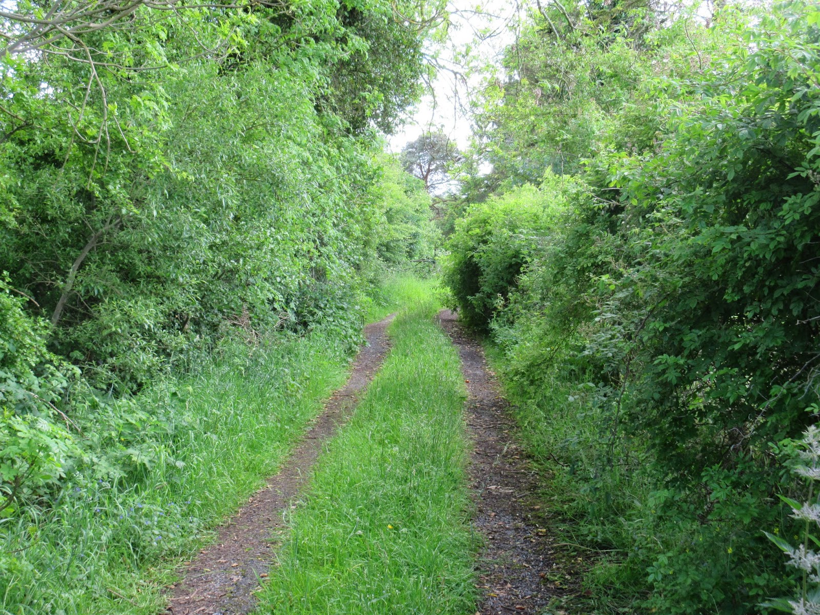
About 700 feet after crossing the highway the road, once again, has grass growing down the middle. There is a single occupied house on the south side of the M6. Then, slowly, the road narrows, becomes overgrown with grass, and the pavement turns to mud. A few yards later, the road ends at a derelict farm. The farm buildings look as if they have not been used in a couple of decades and the house, without doors, has been partially overtaken by trees and bushes.

The derelict farmhouse
I liked the walk so much that in the afternoon I repeated it. The total length of the road is 1.1 miles. I remained respectful of the derelict property, but there was a temptation to explore the farmhouse. I am still unclear as to where the hill, in Moate Hill Road, is/was. During both walks, I only encountered one automobile, driven by an elderly man. On my afternoon walk, I met a father and two young daughters (aged 6 and 8?) riding their bikes over the M6. Both little girls were struggling to get their small bikes to the top of the bridge. The walk was one of the great experiences exploring on a whim, not always rewarded but something to experience. 
On the return trip, entering Moate


Wednesday, June 4, 2014

Coosan Point / Lough Ree Park

Coosan Point Road, with the church in the distance
After seeing a sign for Coosan Church, I altered my plan and decided to take a chance to see if it was an older church (perhaps from the 18th or 19th century). This meant that I was abandoning my intended plan to walk along the Shannon River in West Coosan. Nevertheless, the path to the church was on Coosan Point Road, and armed with an iPhone, I decided to follow that road to the end. Very soon after turning onto the road the church came into view – it was not 19th century. In fact, the sign out front read: “Our Lady, Queen of Peace, Coosan, 1973.” I pressed on.
From Coosan Road, the Point is approximately 2.1 miles each way. I knew by choosing this path I had a long hike ahead of me. The road led through a residential area that gradually become more rural. Although a mostly sunny day, the wind had a touch of coolness to it, perhaps portending the rain that was supposed to come the following day. At the intersection of the last turn off before reaching the point (which is still a mile away), Coosan National School sits in an isolated setting. The school is using portable classrooms (something I remember from my high school days), so it appears that there is no shortage of children in the area.
For a brief portion of the walk, just past St. Kiernan’s Cemetery, there is no shoulder to walk on, so it can be daunting as automobiles approach. When cars go by, you have to trust that the drivers are not texting or have not had too much to drink at the park. Past the cemetery the speed limit increases. Although it is 60km/h, and the road narrows, the cars actually go much faster than that. Nevertheless, my sense is that Irish drivers are more cognizant of pedestrians than Americans. This notion is buoyed by the number of walkers and runners I passed during my various walks in Ireland.
Old farmhouse
Remnants of an old stone building near the point
As I neared the point, I occasionally caught a whiff of peat burning. It is one of the most pleasant and evocative smells I know. I always muse to myself about caring some peat back home in my luggage in order to take the smell home with me. With my relatively new iPhone, I have almost everything that a chronicler / aspiring writer would want. In my pocket I have something to take photographs, write notes, record sounds, search maps and potential sources of information; however, despite the incredible technological revolution of the past two decades there is still nothing to capture and record smells. My trips to the Irish countryside never seem complete until I can once again get a brief sample of the enticing aroma of peat moss heating rural homes.
Once I reached the point, I found the park there to be enchanting. The point is on Lough Ree, where the River Shannon actually forms a large lake. Although I was unable to do this on the current trip, something that I found tempting was that many of the islands in the lake have the ruins of houses, churches and monasteries for exploration, which are only accessible by boat (kayak, motor, or canoe). Several people in the park were enjoying a Saturday cookout or the playground for children. There were many boats in the marina. The mild sunny day made for an excellent time of exploration.
Lough Ree with islands
Returning to Athlone by foot I passed a woman with a rolling shopping cart near the Coosan Pub. As I neared her, she asked me in a thick Irish accent, “Are you enjoying the weather?” I replied that I was very much and asked her if she was as well. Her reply was confusing, “Oh no, I had to go out for pears.” I am not sure that the woman said pears or not – that is what it sounded like. I have wracked my brain for several days now thinking of what she meant and I cannot come to any other conclusion. My reaction was to laugh nervously and bid her a good day. I could not think of anything else and did not want to be dragged into a crazy conversation.


Monday, June 2, 2014

Impressions of Athlone

"Locals" in Athlone
Each time I visit Athlone, I find it an interesting place; however, over the last several years I have noticed an appreciable decline. At first glance, a relatively new KFC seems out of place but, upon reflection, it is probably symptomatic of the economic difficulties of the city. Athlone is a mixture of nice, neat houses with pretty gardens alongside derelict homes and boarded properties. Some businesses thrives, while others experience more difficult times. Walking through the city center there are many vacant shop fronts. There was a building diagonally from the Arch House B&B that had recently burnt the last time I was here. The building has been dismantled, but a fence still surrounds the site. It now has anti-capitalism literature affixed to it.
Road marker 
Yet for all the problems of the city, it still retains very interesting features. Along with fascinating churches, a castle, and Sean’s Pub, there are many historical artifacts that dot the city. I stumbled on one quite by accident. A weathered mile marker, which reads “Dublin 60, Ballinastoe 12,” sits seemingly forgotten on Irishtown Street (An Baile Gaelach). Despite internet searches I have yet to turn up any information about.

Former Midlands Great Western Station 
Railroad Bridge
More celebrated is the abandoned Midlands Great Western Station. From August 1851 until January 1985 this was the primary railroad station for the city. The former station is now used for offices and storage while some of the other buildings in the complex sit derelict. Adjacent to the station, crossing the River Shannon, is the Railway Bridge, a slender and sleek bridge that was built in 1850-51. Originally the middle section of the bridge opened up so that twice a year yachts could pass through on the way to Lough Ree to take part in a regatta. In the 1970s this feature was removed; however, the bridge remains as one of the symbols of the industrial past of Athlone.
Coosan Tavern
Of course like many Irish towns, there are several pubs. Of course, the most famous is Sean’s Pub. Coosan Tavern, outside the center of the city, displays the advertising battle between Guinness and Heineken. The oddly named Nuts Corner displays some of the more traditional Guinness advertising that is fun to find across Ireland.

Finally, while on a walk in the canal area I saw this water tower off in the distance. On my final afternoon in Athlone I set off to find it and walked through some decidedly non-tourist areas. Nevertheless, with not too much trouble, I made my way through Battery Heights and photographed what I think is an odd-looking tower.
Guinness Advertisement
at Nuts Corner


Water tower at Battery Heights 


Sunday, June 1, 2014

Shannon Bank Nature Trail Walk

The trail near Magazine Road and Cherryfield Avenue.The By-Pass Canal is visible in the foreground, while therailroad tracks and abandoned buildings, once associated with the former Midland Great Western Train Station,is in the background. 
This five kilometer trail begins on the west bank of the River Shannon, eventually meandering along the Athlone By-Pass Canal (constructed in 1757) and ends in the Big Meadow (An Chluain Mór), along the shore of the Shannon just south of the city.  While the trail skirts the west end of the city, and traverses several neighborhoods, for the most part it is a peaceful and relaxing walk with many opportunities to see birds and wildlife. The primary objective of the trail is to highlight the natural beauty of the area; however, there are several human enterprises that catch the eye as well. The trail takes the walker by the famous railway bridge that traverses the Shannon, pretty houses and interesting neighborhoods.

A Moorhen roosting on a rowboat along the canal. 

An unidentified bird along the shores of the Shannon

A fellow traveler on the trail

Saturday, May 31, 2014

Sean’s Pub (Athlone)

In the shadow of the Adamson Castle, there is a small traditional Irish pub called Sean’s. It has the distinction of the claiming to be the oldest pub in Ireland, which in 2004 was certified by the Guinness Book of World Records. Circa 1680, the pub was known as “The Three Blackamoor” and that name is still used on the front of the bar as well; however, an even older name suggests that it was called Luain’s Inn. There is a display case in the bar that shows the wattle and wicker used in the walls of the pub that were uncovered during renovations in 1970s, which, according to carbon dating, suggests that the building was constructed circa 900 AD. Going into Sean’s is like stepping back into history, with some interesting variations. Although there are Irish men sitting in the bar, staring at one another, not saying anything, with their arms crossed, there are also German tourists, taking pictures of each other drinking Guinness with their cell phones.
The physical layout of the building and furnishings helps to give it a cozy feel as well as a sense of history. There are small tables with short stools and saw dust on the floor. A fireplace sits not too many steps from the front entrance. I judge the ceiling to be about 7.5-8 feet high. Over the bar, there are rods and reels, oars, and a hand fishing net fastened to the ceiling for decorative purposes. A collection of pipes mounted to a board hangs behind the bar. Automobile license plates from the United States adorn one section of the bar. A cacophony of newspaper articles, photographs and drawings adorn the walls, making it nearly impossible to find any empty spaces on the walls.
I came to make my periodic pilgrimage to have a Guinness in the old pub. It can take the bar staff up to four or five minutes to pull a pint for you. Sure they are busy, but the staff also practices the correct procedures in pulling a pint. On the Saturday night I made my visit, the patrons were convivial. In addition to the Irish men and German tourists, there were a number of couples having a drink and engaging in conversation. A dim roar of conversation was just audible above a mixture of Rod Stewart, the Corrs, and the Waterboys coming from the speakers. A young woman sitting at the bar, perhaps in her thirties, wearing a black top and pink scarf, sat next to her boyfriend/husband in a Ramones t-shirt and enthusiastically sang along with each of the songs. Occasionally someone will see me sitting by myself, writing in my notebook, and offer an acknowledgement. But I think this is because they feel sorry for me rather than a sense of communal engagement.


Friday, May 30, 2014

Stockholm’s Doors

Fridhemsgatan 18
I made a brief study of the doors to apartment flats in Stockholm during my walks. I find it fascinating that people who live in the blocks are able to walk through these remarkable portals each day. It is certain that to the residents it is a mundane activity and they rarely take notice of the decorations. After a while, most likely, I would not give it a thought either. But the diversity of door decorations is one of the small things that makes Stockholm interesting. Because I do not know anyone in Stockholm, these tantalizing doors are also a gateway to a hidden world. In my mind I assume that what lies behind the doors is as interesting as the doors themselves. Perhaps not. But the doors, nevertheless, area a gateway to an unseen world for most travelers.
Hantverkargatan 86


Banergatan 33

Thursday, May 29, 2014

Prague’s Main Railway Station

Fanta's Cafe 
Many people pass through Praha Hlavní Nádraží (Praha hl.n.) without ever knowing, or seeing, the grandeur of the building – and the repairs that need to be accomplished. Originally opened in 1871 and named the Franz Josef Station, the train station today is a bustling hub that as a modern feel; however, the main concourse built in the 1970s is built beneath an architectural gem. Last year Radio Prague did a feature story discussion the renovations and plans for the Fanta’s Café. The renovations look to be complete; however, the exterior of the building is not often seen by pedestrians is in desperate need of work. Fanta’s Café was originally completed in the first decade of the twentieth century. The art nouveau space has been beautifully restored and the stained glass windows is reminiscent of a Mucha painting.
Reliefs on the exterior of the building 
One can see that the exterior of the building was once exquisite as well. Yet time and neglect has seriously damaged the building. Without know the architectural significance or the fact that the main railway station is underneath, you might expect that the building was derelict and slated for demolition. The statues and reliefs on the exterior of the building, created by Ladislav Šaloun, who also created the famous Jan Hus statue on Old Town Square, are crumbling and in disrepair.

Outside: the state of the building
The first time I came to Prague it was through the central train station. I do not remember a lot of specifics, except in my mind the station was clearly influenced by the communist era. It was dark and drab. There were dire warnings to travelers about unauthorized taxis and swindlers who preyed on unsuspecting tourists. Today, the central station is much more in line with other European train stations. It is much lighter and has all the requisite newsstands and shops. But the real gem, like those of Grand Central Station and Thirtieth Street Station, is hidden for the curious to find.